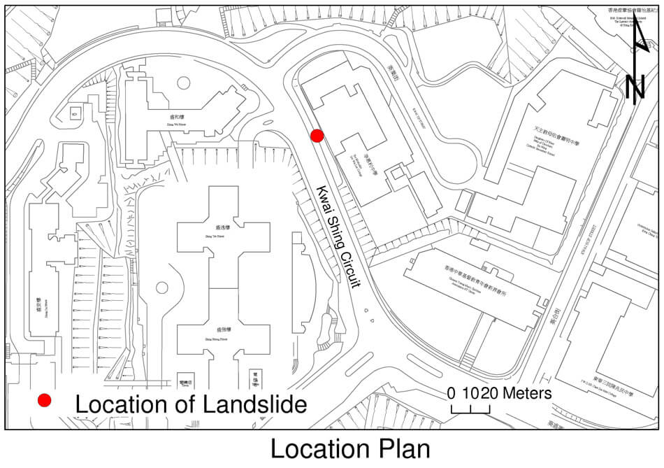
The 12 September 2007 Rockfall at Kwai Shing Circuit, Kwai Chung
Basic Data
Material:
Moderately decomposed granite
Feature Affected:
Cut slope No. 7SW-C/C67
Volume:
0.5 m3 of rock
Report Reference:
GEO Report No. 263
Description
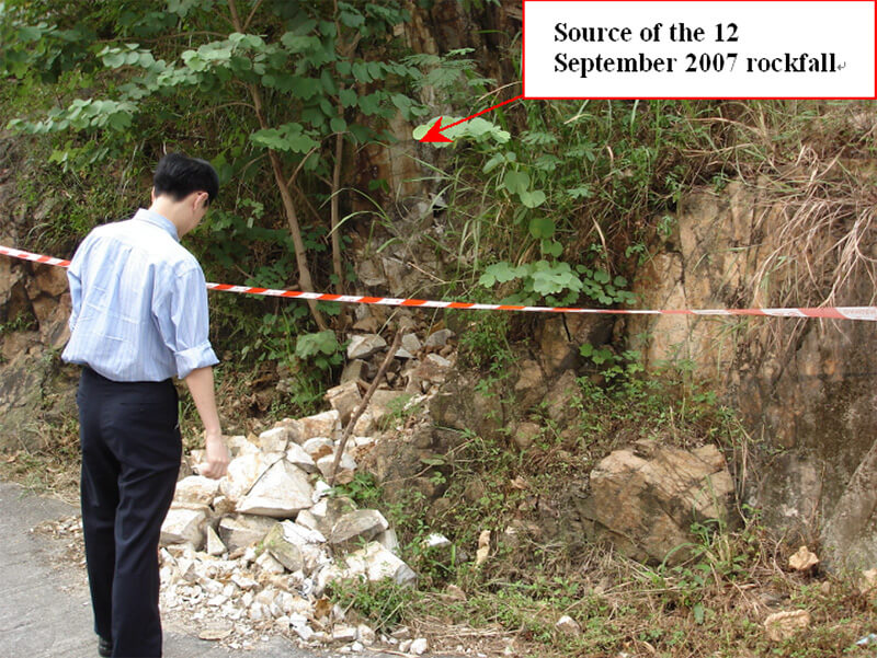
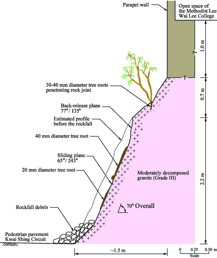
The rockfall occurred on slope No. 7SW-C/C67 at Kwai Shing Circuit, Kwai Chung after a light rainfall. The rockfall incident involved the detachment of a small rock block (about 0.5 m3) from the rock cut portion at the northern middle portion of the slope. The rock block fell from a height of about 2.2 m and came to rest on the edge of a pedestrian pavement at the slope toe. No casualties were reported and no closure of the pedestrian pavement was implemented as a result of the incident.
The failure was probably triggered by wedging action of the tree roots on the rock joints, and was a planar slide on unfavourably orientated joint plane, possibly with the build-up of transient water pressure due to the rainfall on 12 September 2007.
Observations
Post-failure inspections revealed that much of the rock surface at the rockfall source area was covered with overgrown vegetation, including shrubs and trees up to several meters high, the growing of which on the rock surface might have caused the rock mass to deteriorate progressively by way of joint dilation and fracture. The effect of the tree roots on the rock joint dilation might have been a key contributory factor to the rockfall incident.
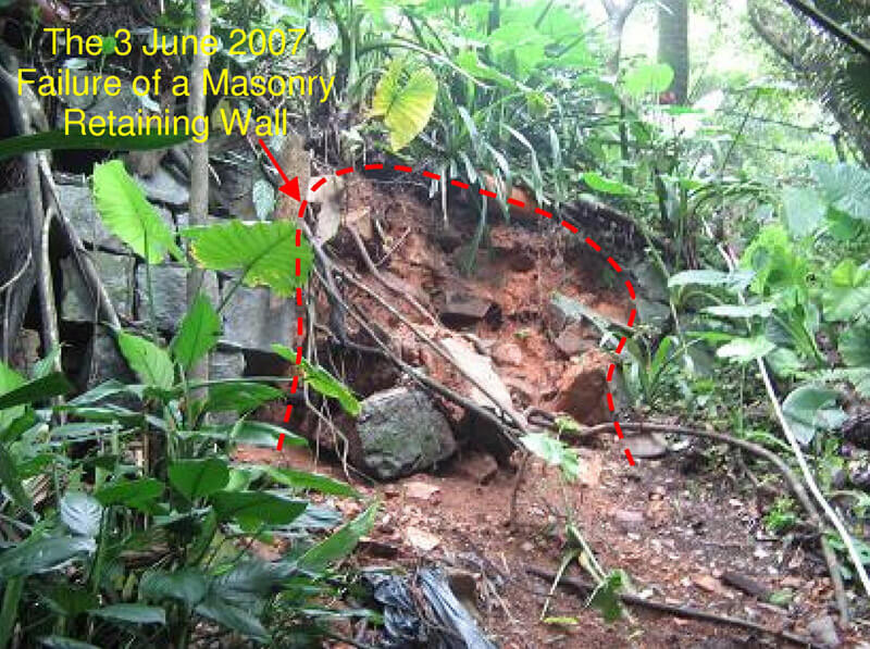
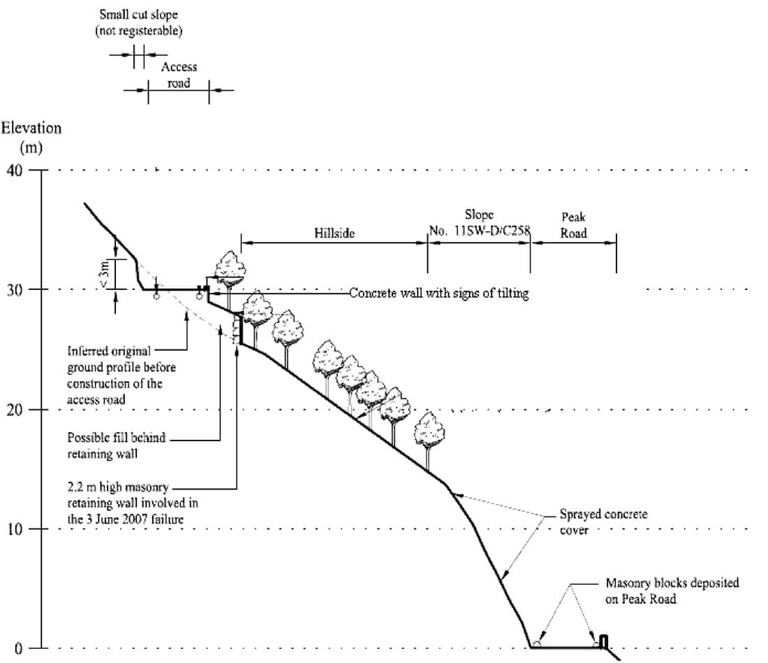
Review of the 3 June 2007 Failure of a Masonry Retaining Wall on Hillside Adjacent to No. 84 Peak Road
Basic Data
Material:
Masonry blocks
Feature Affected:
Masonry retaining wall Peak Road around No. 84
Volume:
1 m3
Report Reference:
GEO Report No. 250
Description
The landslide involved primarily the detachment of some masonry blocks from an unregistered 2.2 m high old masonry retaining wall, which is located on a steep disturbed hillside at some distance above a 14 m high steep cutting at Peak Road. Some of the detached stone masonry blocks reached Peak Road, resulting in temporary closure of one lane of Peak Road. Only intermittent light rainfall was recorded for the 48-hour period prior to the incident.
The failure was probably the result of progressive deterioration of the dilapidated masonry retaining wall, which has not been subject to regular maintenance and shows severe signs of distress.
Another small (max. 1.4 m high) concrete retaining wall is present near the crest of the disturbed hillside above the masonry retaining wall. Part of the concrete wall shows signs of distress in the form of tilting.
Observations
The failure highlights the potential landslide hazard associated with disturbed hillsides close to public facilities.
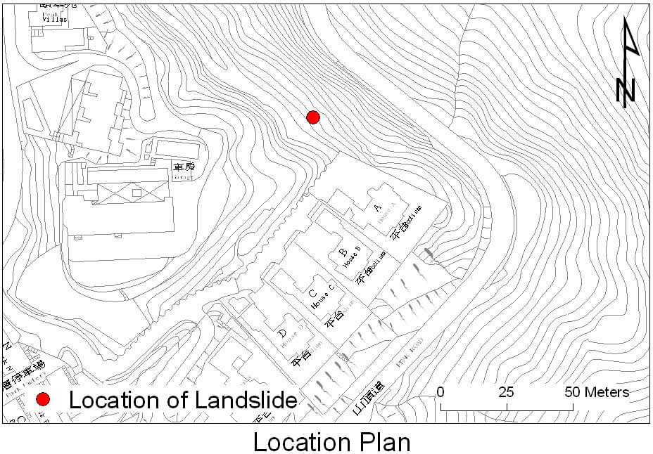
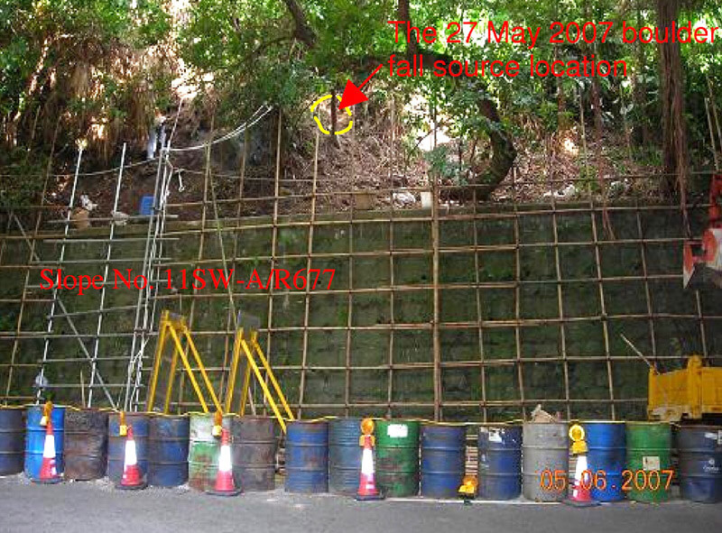
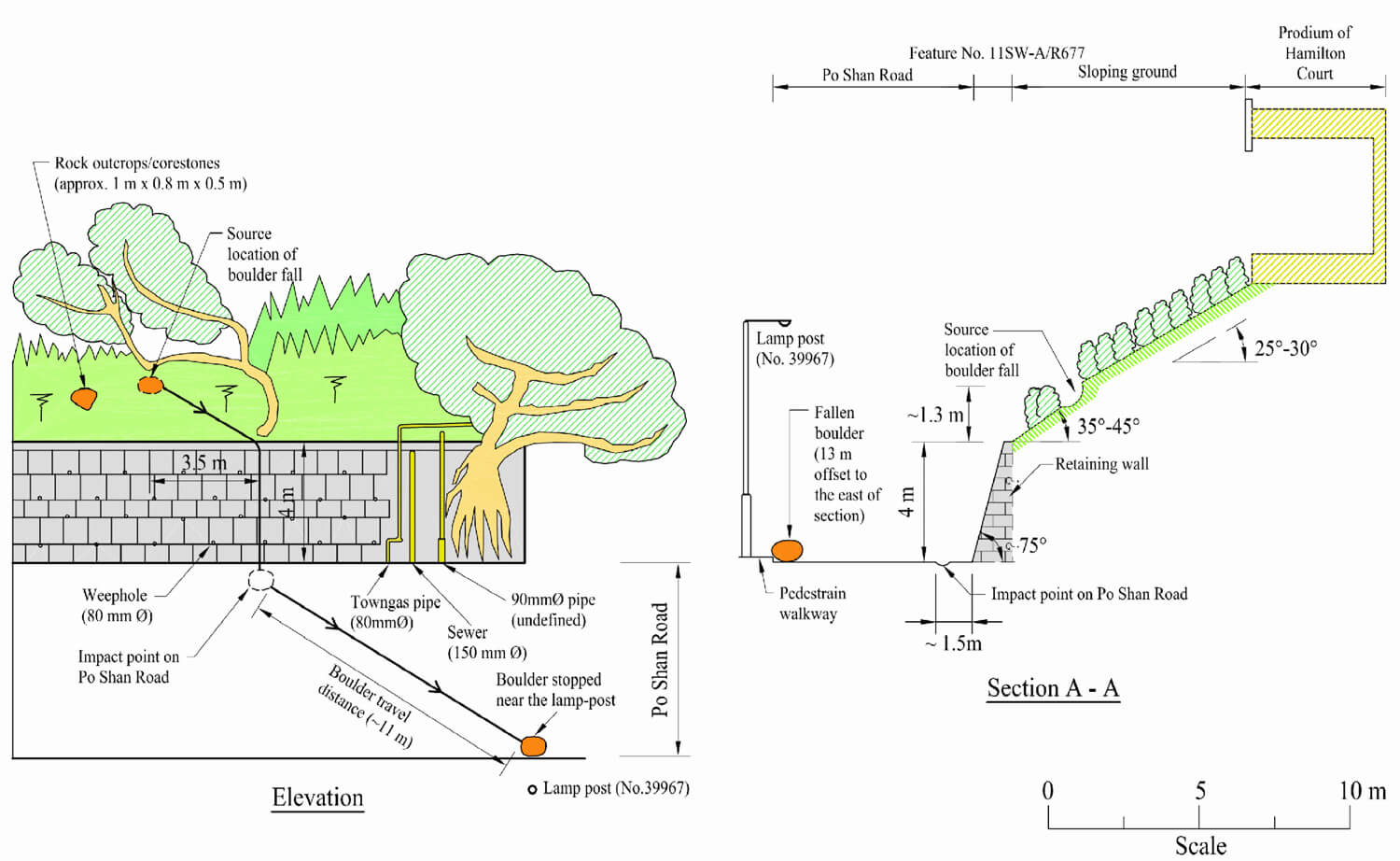
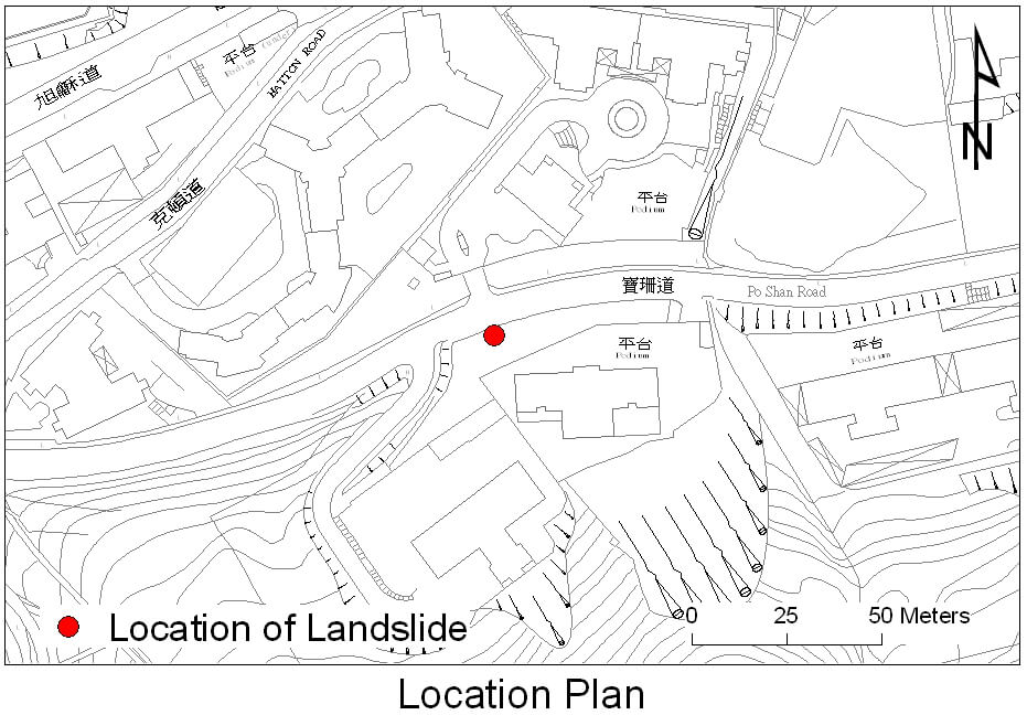
Review of the 27 May 2007 Boulder Fall Incident on the Sloping Ground above Retaining Wall No. 11SW-A/R677, Po Shan Road
Basic Data
Material:
Colluvium/Completely Decomposed Tuff (CDT)
Feature Affected:
Sloping Ground above Retaining Wall No. 11SW-A/R677
Volume:
0.4 m3
Report Reference:
GEO Report No. 268
Description
The incident (involving detachment of a boulder of 0.4 m3 in volume) occurred during fairly light rain on a 5 m high sloping hillside above a 4 m high masonry retaining wall. The detached boulder caused minor damage to the pavement and came to rest on Po Shan Road. The incident did not result in any casualties. One lane of Po Shan Road was temporarily closed to traffic following the incident.
The source area of the boulder fall is located on a relatively steep, sloping hillside scattered with loose boulders. The adverse site setting and unfavourable topography of the boulder fall source area probably played a contributory role in the incident.
The groundmass of the hillside may have been subject to local deterioration due to the adverse effect of tree root action. Uncontrolled discharge of stormwater from the private development above could also have contributed to progressive soil erosion surrounding the perched boulder and loss of support.
Observations
This landslide incident highlights the problem of pockets of hillside within development areas and the landslide risk posed by a minor failure in an urban setting.
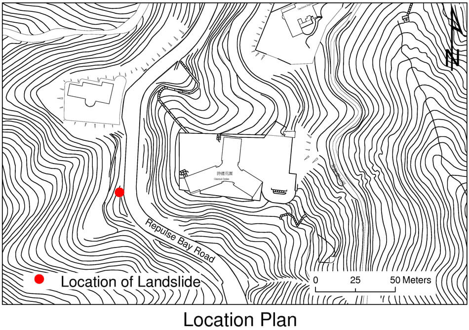
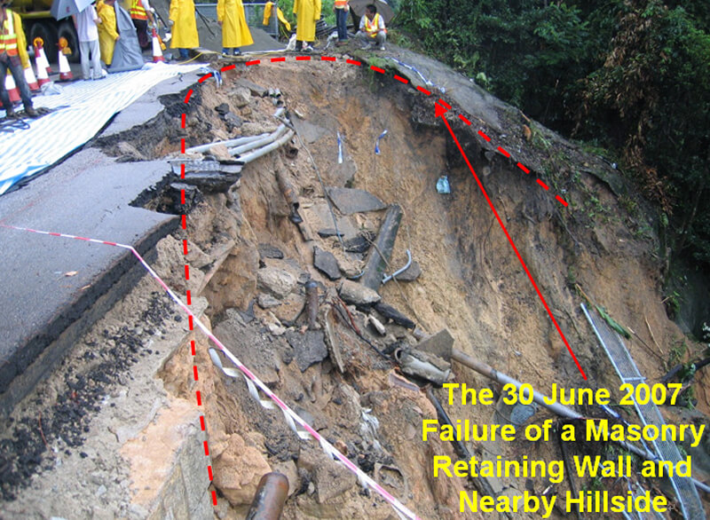
Detailed Study of the 30 June 2007 Landslide on Wall No. 11SE-C/R7 and the Adjoining Hillside at Repulse Bay Road
Basic Data
Material:
Masonry blocks Masonry retaining wall
Feature Affected:
A section of the northbound lane and its adjacent pedestrian footway of Repulse Bay Road; the supply of freshwater to the nearby residents
Volume:
approx. 600 m3 of rock
Report Reference:
GEO Report No. 287
Description
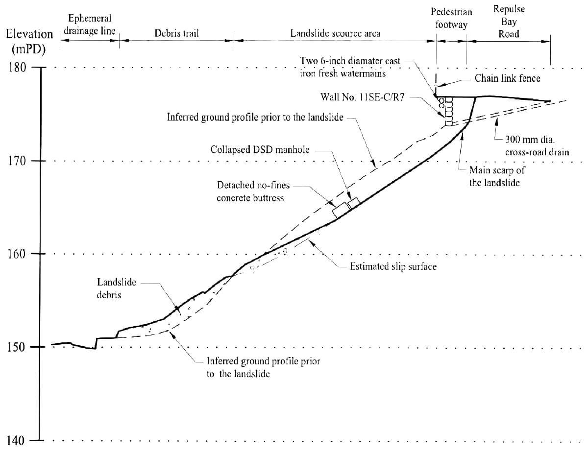
The landslide involving a failure volume of about 600 m3 occurred at the southern portion of retaining wall No. 11SE-C/R7 and the adjoining hillside below Repulse Bay Road during light rainfall. The failure was probably triggered by the bursting of either one or both of the old 6-inch diameter watermains mounted on wall No. 11SE-C/R7. The watermains were in a dilapidated condition, although the previous leakage detection test did not reveal any leakage from the watermains in the vicinity.
As a result of the failure, a section of the northbound lane and its adjacent pedestrian footway of Repulse Bay Road were undermined, and the supply of freshwater to the nearby residents was temporarily suspended. The incident did not result in any casualties.
There has been a history of landslides in 1994 and 1997 due to rupture of the watermains at or in the vicinity of the landslide site. At the time of the landslide, two new watermains had been installed to replace the two subject old watermains but the new watermains were not yet in operation when the landslide occurred.
Observations
The failure highlights the need to replace/repair old, poor condition pressurized watermains located in the vicinity of slope as bursting of the pressurized watermains could occur suddenly without prior signs of warning or leakage.