The 11 August 2005 Landslide on Natural Hillside below Block J of Princess Margaret Hospital, Kwai Chung
Basic Data
Material:
Residual soil, fill & colluvium
Feature Affected:
Natural Hillside
Volume:
15 m3
Report Reference:
GEO Report No. 213
Description
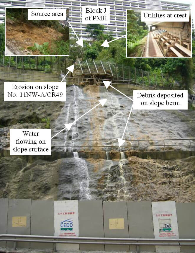
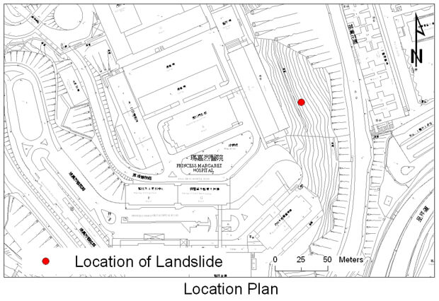
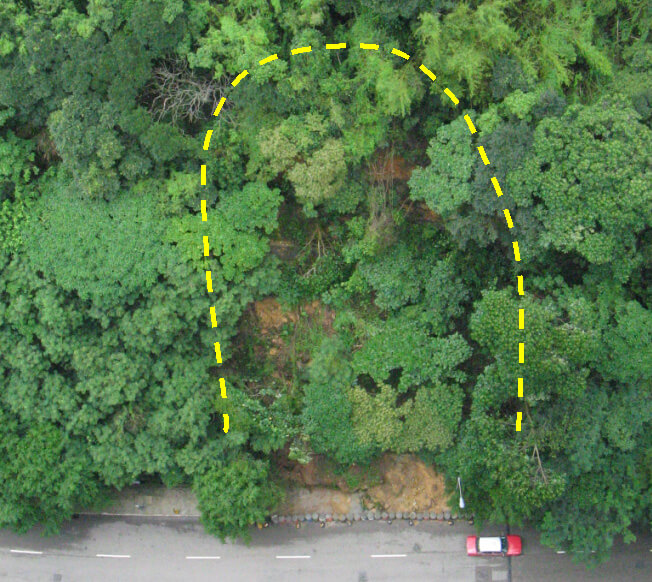
A minor landslide took place on natural terrain below Block J of Princess Margaret Hospital (PMH) during relatively light rainfall (return period < 2 years). The landslide debris caused erosion of the soil portion of slope No. 11NW A/C49 below and most of the landslide debris was deposited on the slope berms and at the toe of the slope. A small amount of the debris overtopped the hoarding at the slope toe and was deposited on Lai King Hill Road. A stretch of the fence along the coping of the retaining wall at about mid-height of slope No. 11NW-A/C49 was severely damaged, and part of it was left over-hanging. Lai King Hill Road was temporarily closed for 20 hours.
Significant water flow from the main scarp of the landslide was observed during the post-landslide inspection. The failure was probably triggered by leakage from a 30-year old, 150 mm diameter buried water pipe (which was in a dilapidated state) at the platform above the landslide source area. It took some seven hours for the responsible parties attending to the incident to locate the source of the leakage and the corresponding valve of the leaky pipe before the supply could be turned off.
The leaky pipe formed part of a "dual pipes water supply system", in which water loss from any one of the two pipes would be compensated by the other pipe. As a result, signs of incipient leakage problems could not be easily observed by the users in PMH.
The maintenance responsibility of the water carrying services of PMH was only handed over to a new maintenance agent some four months before the landslide.
There was a history of leakage or suspected leakage of water-carrying services affecting the hillside/slopes of concern over several years before the occurrence of the subject incident.
Observations
This incident highlights the importance of upkeeping a comprehensive inventory, together with a maintenance manual, of water-carrying services, especially for those that may affect adjacent slopes. Full and updated records of the past maintenance/repair works and leakage detection tests should also be maintained.
The incident also emphasizes the importance of timely retrieval of the records of buried water carrying services, especially under emergency situations.

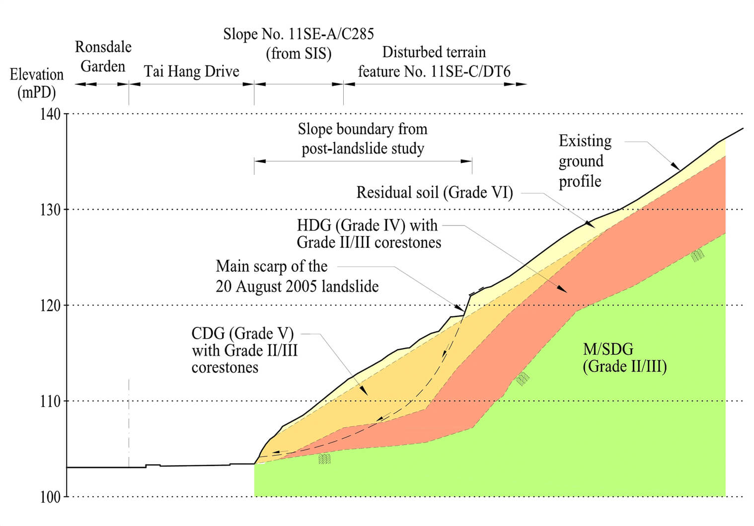
The 20 August 2005 Landslide on Slopes Nos. 11SE-A/C285, 11SE-C/DT1 and 11SE-C/DT6 above Tai Hang Drive, Happy Valley
Basic Data
Material:
Soil and Rock
Feature Affected:
Cut Slope No. 11SE-A/C285 Disturbed Terrain Features Nos. 11SE-C/DT1 and 11SE-C/DT6
Volume:
2,100 m3 (displaced/distressed ground mass)
Report Reference:
GEO Report No. 217
Description
The 20 August 2005 landslide, which comprised 2,100 m3 of displaced/distressed ground mass with a local detachment of about 40 m3, occurred on an engineered, unsupported cut following prolonged and intense rainfall. It also affected the toes of two registered Disturbed Terrain features. As a result, a section of Tai Hang Drive below was temporarily closed.
The August 2005 landslide site has a history of past instability (major landslides of about 50 m3 and 100 m3 in volume in 1983 and 1993 respectively) since the formation of the cut slope in the early 1980's under a private development project.
The August 2005 landslide was partly controlled by adverse geological features (i.e. weak, adversely orientated, relict joints within CDG/HDG as well as some clay-infilled daylighting sheeting joints at the soil/rock interface). An unfavourable hydrogeological setting involving an inferred rockhead depression with a potential of directing groundwater flow towards the landslide site, could be a key contributory factor to the landslide.
Observations
The landslide site was susceptible to failure during intense rainfall given the adverse geological and hydrogeological setting and the past major landslides. The presence of adverse geological features in a local area may not necessarily be readily detected in a routine ground investigation and the cut back scheme in the 1980's was not sufficiently robust to cater for such potential uncertainties.
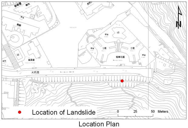
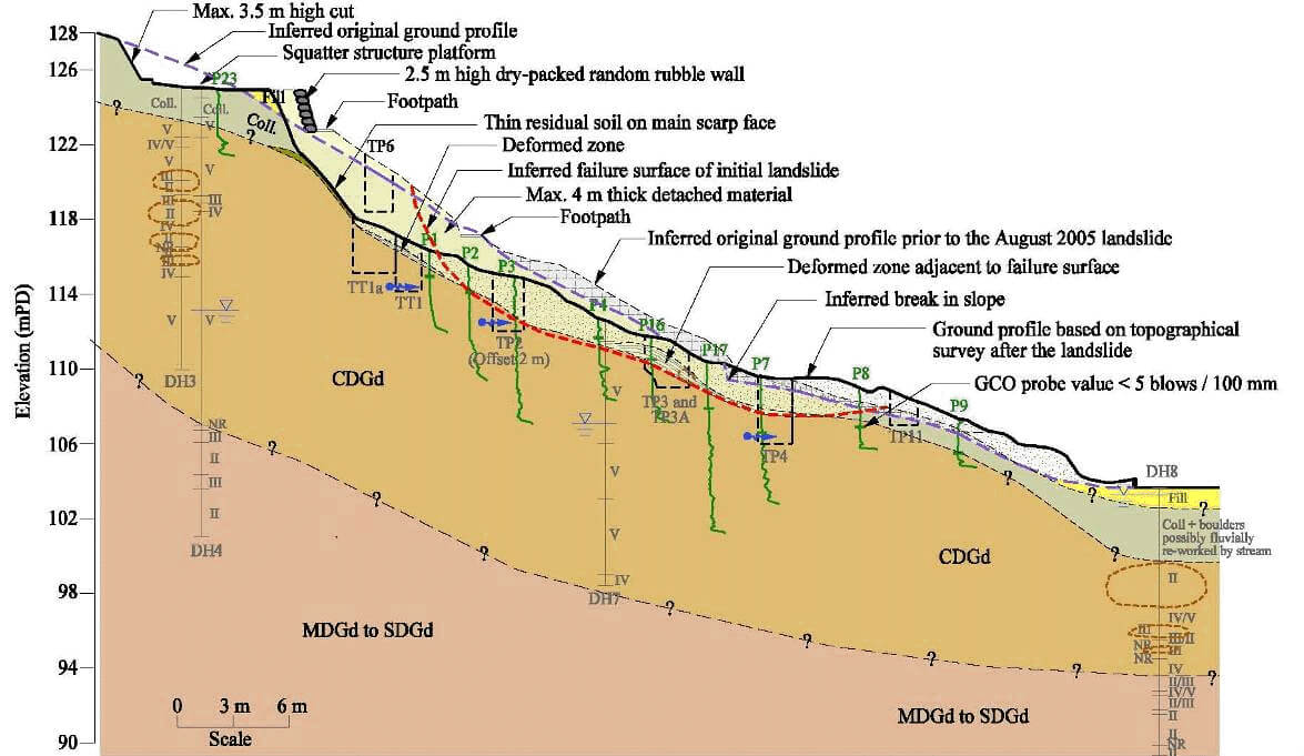
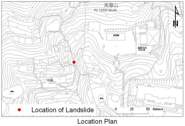
The 20 August 2005 Landslide at Fu Yung Shan Tsuen, Tsuen Wan
Basic Data
Material:
Colluvium/Completely decomposed granodiorite
Feature Affected:
Hillside disturbed by past human activities
Volume:
400 m3
Report Reference:
Report on the Landslide at Fu Yung Shan Tsuen of 20 August 2005
Description
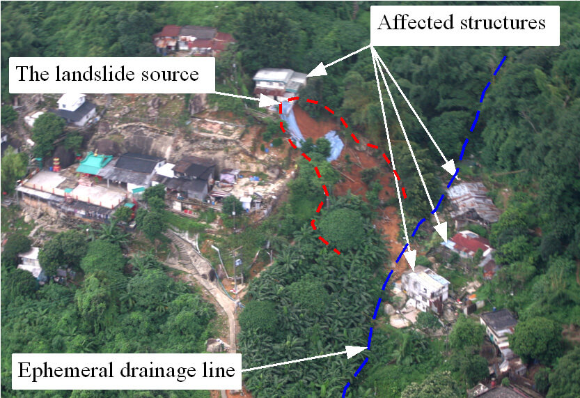
A major landslide occurred on a 28° to 34°, densely vegetated hillside, which has been disturbed locally by past human activities, at Fu Yung Shan Tsuen, Tsuen Wan. The landslide occurred during a severe rainstorm with a return period of about 100 years. It took away a 10 m long section of a footpath, resulting in one fatality and the permanent evacuation of four registered squatter dwellings in the vicinity of the landslide.
The failure was probably caused by the loss of soil suction and the transient build-up of groundwater pressure in the near-surface ground mass, following the prolonged and intense rainfall on 19 and 20 August 2005.
Measurement of soil suctions indicated that the ground mass would take a fairly long time to recover the pre rainfall suction. The nature of the prolonged and intense rainfall, coupled with the soil water characteristics of the ground mass, was probably conducive to the gradual build-up of high groundwater pressure in the near-surface materials.
The uncontrolled and illegal dumping of domestic refuse (which probably took place since the mid 1970s and comprised organic matter and fibrous materials with the capacity to retain water for a substantial period of time) over a significant portion of the hillside gave rise to an unfavourable hydraulic boundary condition that probably promoted the build-up of high groundwater pressure following prolonged and intense rainfall. The over-steepening of the toe of the subject hillside, as inferred from the geomorphological setting, and locally from the 1964 aerial photographs and the presence of a break in slope on the adjacent unfailed hillsides, probably rendered the hillside susceptible to rain induced landslide.
The four squatter dwellings that were permanently evacuated after the August 2005 landslide had been recommended by the GEO for clearance under the Non development Clearance programme in 1992. However, the occupants of these dwellings opted to stay put, and the squatter structures had not been cleared before the landslide.
Observations
This incident highlights that vulnerable disturbed hillsides within squatter settlements are susceptible to landslides during prolonged and intense rainfall.
The landslide also serves to highlight that human disturbances to hillsides and man-made slopes, such as uncontrolled dumping of refuse and illegal earthworks, are liable to adversely affect the infiltration characteristics of the ground. This in turn could render the slope more susceptible to landslides. The landslide risk may increase with time due to inadequate land management control and progressive slope deterioration.
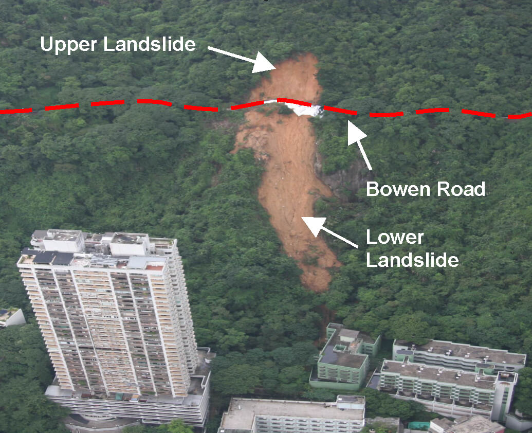
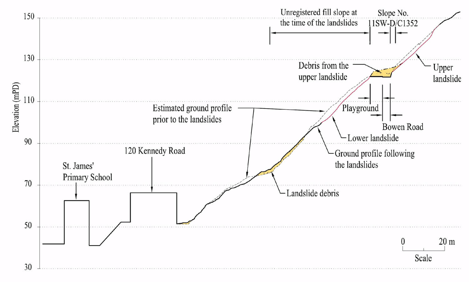
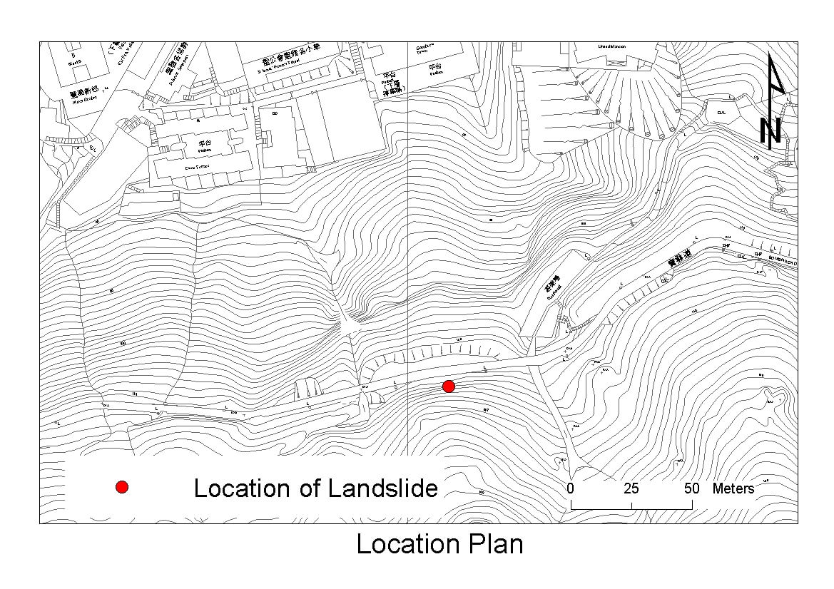
The 20 August 2005 Landslide at Bowen Road above No. 120 Kennedy Road
Basic Data
Material:
Residual Soil/Completely Decomposed Granite/Fill
Feature Affected:
Cut slope No. 11SW-D/C1352 & ground above and below5
Volume:
950 m3
Report Reference:
GEO Report No. 214
Description
Two major landslides occurred above and below Bowen Road during heavy rainfall. The upper landslide (750 m3) affected an old cut slope No. 11SW-D/C1352 and the hillside above, whereas the lower landslide (200 m3) affected a fill platform and an unregistered fill slope (subsequently registered as slope No. 11SW-D/F641 after the landslide) below. The debris from the upper landslide was deposited on Bowen Road and the adjoining playground. Some of the debris from the upper landslide travelled further downslope together with the lower landslide, and nearly affected the buildings at the toe of the hillslope. The incident resulted in the temporary closure of an unoccupied apartment building and a school.
The affected cut slope and the hillside above Bowen Road have a history of slope instability.The 2005 failure was probably caused by the build-up of transient groundwater pressures in the soil mass during severe rainfall. Progressive deterioration of the slope condition, which could have been subjected to weakening effects associated with the previous instabilities, may also have been a contributory factor to the failure.
The lower landslide was probably triggered by the impact and/or surcharging by the debris of the upper landslide.
Observations
The incident illustrates the possible knock-on effects from one landslide to another, which could lead to more significant consequences posed to the downhill facilities.The potential hazards to developed areas by old, previously undetected loose fill on relatively steep hillsides covered by dense vegetation are also highlighted.
The 20 August 2005 Landslide and Boulder Fall Incident above Slope No. 11SE-C/C60, Tai Hang Road
Basic Data
Material:
Completely Decomposed Granite
Feature Affected:
Natural Hillside above Cut Slope No. 11SE-C/C60
Volume:
5 m3
Report Reference:
GEO Report No. 226
Description
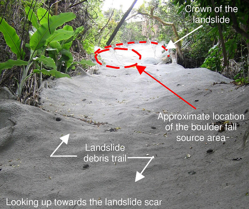
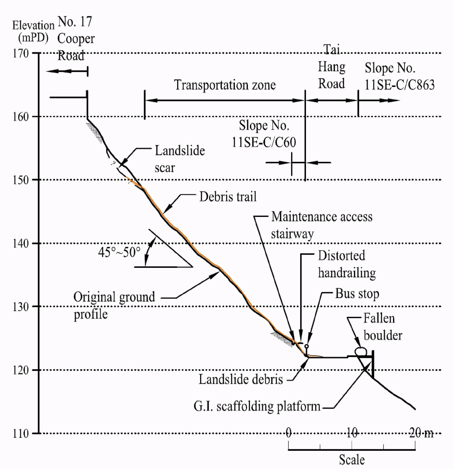
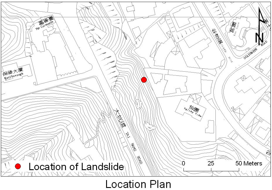
The incident (involving 5 m3 landslide debris and a boulder of 2 m in dimension) occurred during moderate rainfall on a relatively small natural hillside 'pocket' within the Development Line, which broadly defines the boundary between natural terrain and developed areas in GEO's Natural Terrain Landslide Inventory. The detached boulder damaged the maintenance access stairway on the cut slope below and came to rest on a temporary steel platform of a ground investigation contract on the downhill side of Tai Hang Road. Both lanes of Tai Hang Road were temporarily closed to traffic following the incident.
The subject hillside has a history of instability, including a boulder fall in 1987. The 2005 failure was probably rain-induced. Given that there were no obvious adverse changes in the environmental setting of the site, progressive deterioration of the slope condition may have been a contributory factor to the incident.
It was fortuitous that the failure occurred before the rush hour, as otherwise the potential consequence could have been more serious. The detachment of a sizeable boulder from about 20 m above a fairly busy road in the urban area posed a significant hazard to the road users.
Observations
This landslide incident highlights the problem of progressive deterioration of natural terrain and the potentially significant consequence of even a small landslide or detachment given the densely developed urban setting.
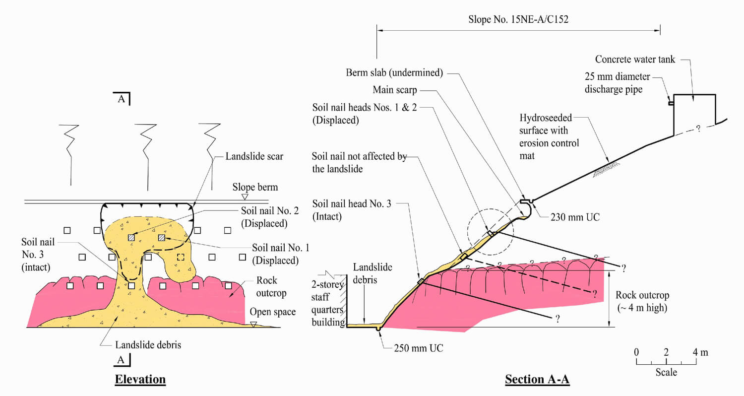
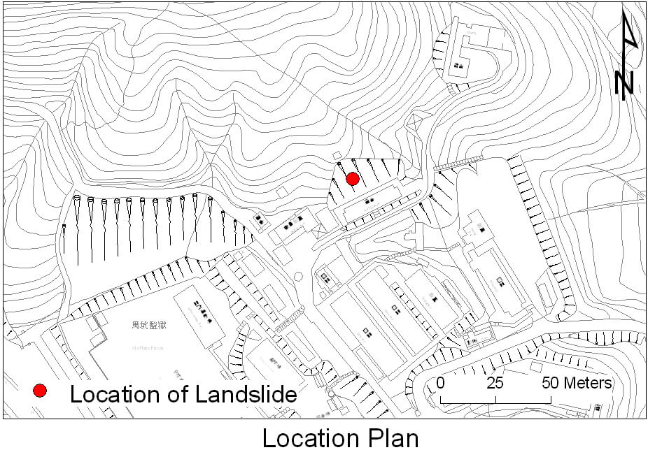
The 20 August 2005 Landslide at Ma Hang Prison, Stanley
Basic Data
Material:
Completely Decomposed Tuff (CDT)
Feature Affected:
Cut Slope No. 15NE-A/C152
Volume:
35 m3
Report Reference:
GEO Report No. 247
Description
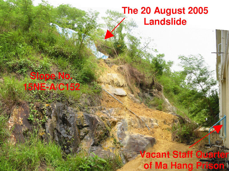
The landslide (35 m3 in volume) occurred on a soil-nailed slope during a moderate rainfall, some 4 years after completion of LPM upgrading works. The slope upgrading works comprised soil nailing and replacement of the existing hard surface with a vegetated cover.
The landslide is classified as an 'internal' failure of the soil-nailed slope, with the detachment occurring within the active zone comprising CDT.
Persistent seepage from the soil/rock interface and from the joints in the rock mass below the failure scar observed following the landslide and also in the historical records suggests that the locality of the failure could be conducive to the build-up of transient seepage pressure or a local perched water table.
The replacement of the hard surface cover with a vegetated cover probably played a contributory role in the failure by adversely changing the infiltration characteristics of the slope.
No prescriptive raking drains were provided as part of the upgrading works, including the locality of the failed area where seepages were observed in past inspections and where the local hydrogeological setting is conducive to the possible build-up of seepage pressure or perched water table during rainfall.
Observations
This incident highlights the need for more generous provision of subsurface drainage (e.g. prescriptive raking drains as contingency provision) for slopes subject to adverse infiltration, although one should be mindful that raking drains may not always be able to relieve perched/transient groundwater table, depending on the local hydrogeological setting.
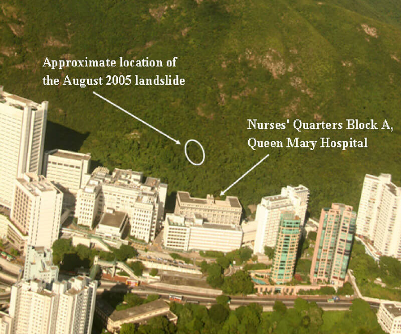
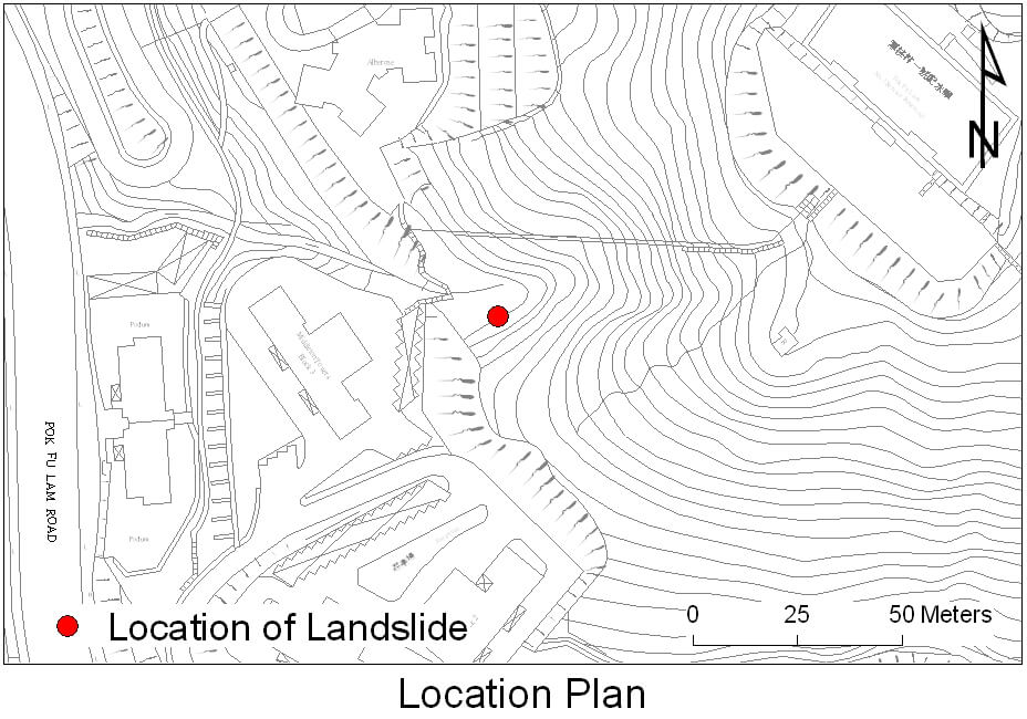
The 20 August 2005 Landslide Behind Nurses' Quarters Block A, Queen Mary Hospital, Pok Fu Lam
Basic Data
Material:
Colluvium/Completely Decomposed Tuff
Feature Affected:
Natural Hillside behind Queen Mary Hospital
Volume:
About 1,000 m3
Report Reference:
GEO Report No. 242
Description
The landslide, involving a distressed zone (about 1,000 m2 and up to about 3 m deep) on a natural hillside with a downslope displacement of about 1 m, was noted following heavy rainfall. As a result of the slope movement, an exposed pressurized water pipe, which was installed across the subject hillside between 1949 and 1963, was ruptured. In view of the significant distress of the hillside, part of the Nurses' Quarters Block A at the toe of the affected hillside was closed for about four months.
The subject hillside catchment has a history of instability. The ground within the catchment probably has an ongoing process of intermittent movements.
The 2005 distress was probably caused by a transient build-up of water pressure in the ground mass following heavy rainfall and appeared to have been a reactivation of the past slope movements. The movements occurred principally largely within the saprolite and were controlled to a large extent by relict joints.
Observations
The incident depicts the subsequent progressive nature of development of failure of natural hillsides and highlights the risk posed by distressed natural terrain in close proximity to developments. It also highlights the difficulty of identifying subtle distressed features on hillsides, including persistent tension cracks. This incident may illustrate the susceptibility of Historical Landslide Catchments to progressive deterioration of the hillside condition and reactivation of previous slope movements.

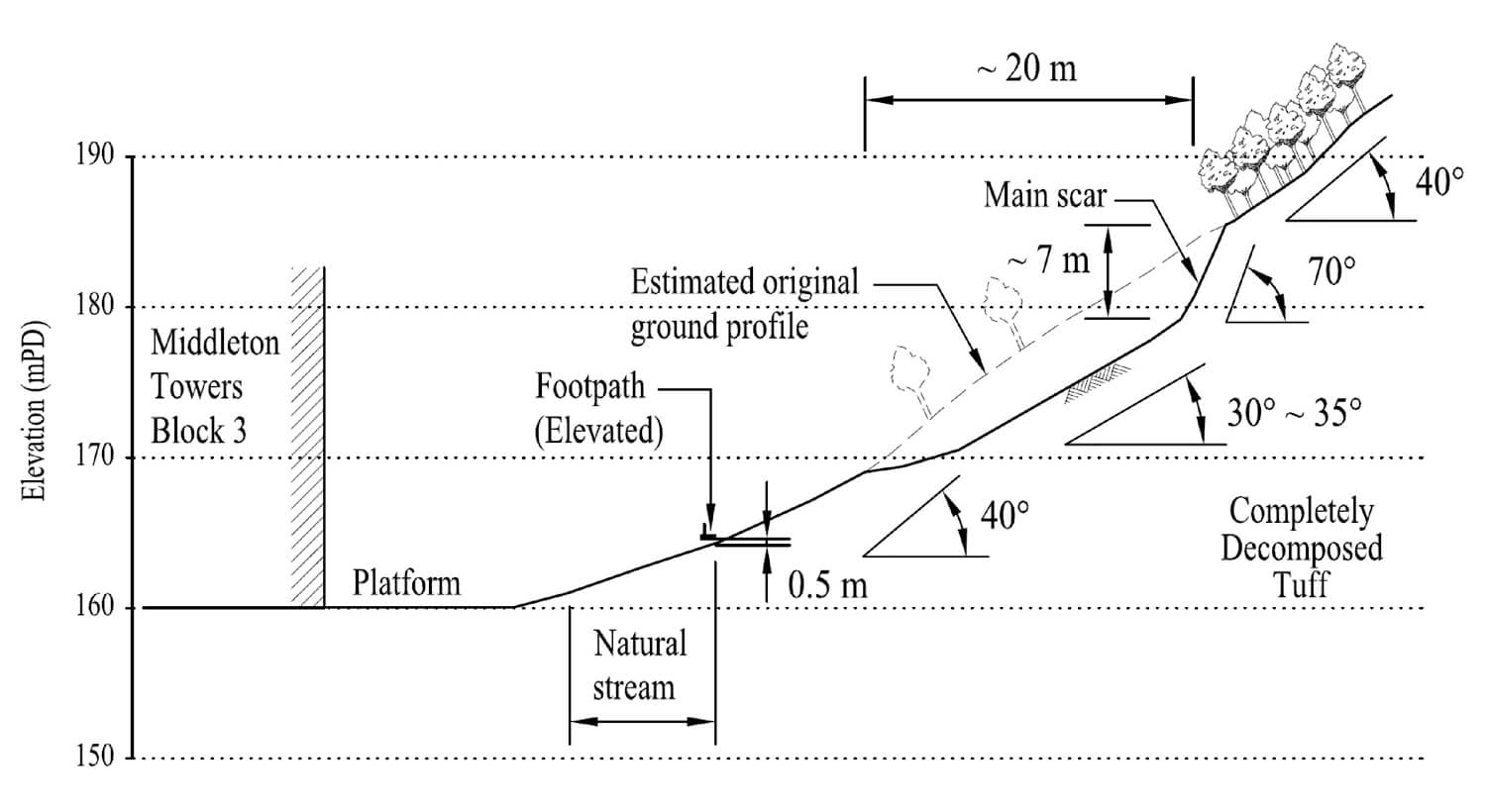
The 20 August 2005 Landslide on a Natural Hillside above Block 3, Middleton Towers, Pok Fu Lam
Basic Data
Material:
Decomposed Tuff/ Colluvium/Residual Soil
Feature Affected:
Natural Hillside to the east of Middleton Towers
Volume:
200 m3
Report Reference:
LSR 9/2006
Description
A major landslide (200 m3) occurred on a natural hillside within a small catchment (about 7,000 m2) located about 50 m to the east of Block 3 of Middleton Towers. The landslide debris was deposited onto a natural drainage line, part of which travelled to a covered car park to the east of Block 3. The failure was not particularly mobile because the debris was deposited on a gently sloping section (10° to 20°) of the drainage line where its flow direction changes. Surface water subsequently overflowed from the choked drainage line and discharged onto the platform of Block 3, inundating the platform area with debris outwash.
The subject hillside catchment has a history of instability and is probably subjected to progressive deterioration. Field mapping revealed that the past failures might have resulted in a local break in slope that is not fully reflected by the contours of the published topographical maps, and an oversteep landslide scar is liable to predispose the terrain to further failures.
The August 2005 rainstorm, with an estimated maximum return period of about 37 years, was the most severe in terms of medium to long duration rainfall since installation of the nearest automatic raingauge in 1978. The close correlation between heavy rainfall and the timing of the landslide suggests that the failure was probably rain-induced.
Observations
Attention should be paid to the natural hillsides that have a history of instability, especially those close to developments. The landslide was initiated as an open hillside failure but subsequently transformed into a channalised debris flow. This incident illustrates the possibility of changes in the debris flowpath which may depend on the site setting and the momentum of the landslide debris at the change in alignment of the drainage line. The subject hillside catchment has been identified as a Historical Landslide Catchment under the ENTLI project.